Archive | How to do Spatial Analysis for Archaeology RSS feed for this section
Link

http://spatialtech-humanities.com/

11 Aug

I recently migrated all the content from this blog to my new website!

www.spatialtech-humanities.com, I’m looking forward to see you there.

Hi all,

I hope you are having a great summer! Just a quick note to say that I’m migrating my blog to my new website. I hope you like it and continue following my research. Don’t hesitate to contact me anytime šŸ™‚

CAA2012 – Extended Deadline

1 Dec

CAA2012 – Extended Deadline

It has been a crazy day at CAA2012 HQ. We are now approaching 300 submissions for the conference, with an amazing range of topics. So, thank you VERY much for your submissions.

We have also received a lot of requests for slightly more time, and so we have decided to extend the deadline until 11:59pm UK time on Wednesday 7th December. Submission is via theĀ Open Conference System.

We will still endeavour to release the programme before Christmas so to help the referees please get your submissions in as early as possible.

We will also be announcing the registration fees and process next week.

The website also carries details of the StudentĀ BursaryĀ application process which is now open. Also remember theĀ Recycle Award.

Finally you can now follow us on twitter viaĀ #caasoton

Debating Spatial Archaeology

28 Nov

Hey guys, I thought this could be of great interest šŸ™‚

DEBATING SPATIAL ARCHAEOLOGY.
Internationl Workshop on Landscape and Spatial Analysis in Archaeology
Santander, June 2012

Debating Spatial Archaeology

The study of spatiality is one of the most important issues in Archaeology. Since the very first moments of the discipline, the understanding of spatial relations has been a key factor for interpreting past social dynamics. The importance of spatial analyses has led to the appearance of specific issues within Archaeology, such as Landscape Archaeology, Spatial Statistics, Cognitive Archaeology, etc., all of which can broadly be included within the Spatial Archaeology issue. On the other hand, in recent years there has been great improvement in recording methods and analysis tools, mainly thanks to the generalization of GIS, which has contributed to the development of spatial analyses.

However, these methodological improvements and conceptual developments have not always had an accompanying parallel theoretical dissertation about the real application of spatial analyses to archaeological interpretations; spatial analyses usually focus on geographic data and cartographic outcomes which have to be inserted into a previously defined, fixed framework valid in its own right, instead of really trying to link those results with the proposed interpretations. In these cases, space is automatically assumed to be a fully significant concept, either from an economic or relational perspective, but without a serious discussion of what it really means with relation to each particular case.

The main aim of theĀ Debating Spatial ArchaeologyĀ International Workshop is to provide a debate forum where archaeologists can discuss whatĀ spaceĀ means in Archaeology, how it is perceived and interpreted by archaeologists, and why. Keeping in mind the need for a connection between methodology issues, analysis results and interpretations, participants are encouraged not only to analyse spatial variability, but to point out the probable reasons for such variability from in terms of social space, as well as to discuss how their spatial analyses can improve the understanding of social and historical dynamics within their case studies.

http://www.spatialarchaeology.unican.es/Default.aspx

Script to sum values from one field and place them into another field ARCGIS

31 May

Hi guys,

Today I had to sum the values from a field from a raster file and write the output into another. Despite you’ll think that Arcgis would have a tool to do this in a simple way, I found out that this was not necessarily the case :p

I wrote an script in python to solve this. I hope you find it useful.

What the script does is to sum the values from a field writing the result into another field in the table.

You can copy this and add it into your toolbox šŸ™‚

The arguments that are necessary are:

#(1) table = table containing the field you want to sum

#(2) fieldtosum= the field that you are going to sum

#(3) fieldwrite= the field in which the sum is going to be writen

#Script
import arcgisscripting, sys
gp = arcgisscripting.create()
table = sys.argv[1]
fieldtosum = sys.argv[2]
fieldwrite = sys.argv[3]

rows = gp.SearchCursor(table)
row = rows.Next()
p = 0.0
while row:
p += row.getvalue(fieldtosum)
print p
row = rows.next()
#calculate field
gp.calculatefield(table,sys.argv[3],float(p),”PYTHON”)
#End——-

Very soon I’ll be writing about how to do a series of variants of visibility analysis such as “Directional Viewsheds” and “Higuchi Viewsheds” that can be very useful in archaeology šŸ™‚

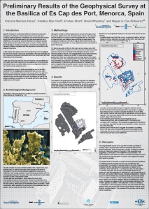
Preliminary Results of the Geophysical Survey at the Basilica of Es Cap des Port (Menorca, Spain)

17 Feb

Geophysical SurveyUntil recent, specific research has aimed to understand settlement dynamics during Late Antiquity in the Balearic Islands (Spain). Results obtained from previous projects show that palaeochristian basilicas played a fundamental role in territorial structuration during the IV and VIII centuries AC (Cau et al., 2006). However, further research has also concluded that there seems to be a difference in the dynamics observed between the basilicas located inland and the ones located in the coast. While the basilica of FornĆ”s de TorellĆ³ seems to condense settlements in its surrounding, other basilicas such as Son Bou and Es Cap des Port, give the impression that they did not attracted almost any population. In order to investigate further this observation, it became necessary to know the real extension of the basilicas. In the case of Es Cap des Port, the full extension of its architecture is not known, and there is evidence of the existence of other structures than those that are currently visible and that corresponded to the church.

These gaps in knowledge of the adjacent structures to the basilica and its immediate area, are due to the lack of specific studies focused on solving the functionality and use of these structures, the relationship of the various settlements near these basilicas, and whether or not there is a direct relationship between them and the structuration of the late antique landscape. In this manner, the project aimed as a first step to determine the actual extent of Menorca Christian buildings and their annexes, advancing (1) interpretive hypothesis about their functionality and their relationship to the landscape and (2) investigating the role of the rooms or structures associated to the main buildings. The purpose of this poster is to present the preliminary results of the survey carried out in the basilica of Es Cap des Port (Fornells, Menorca) in 2009. Through geophysical methods, a number of archaeological features were successfully identified allowing us to suggest preliminary interpretations and further directions in the research.

Download this poster!

How to increase the allowance in the number of unique values in a raster for Classification

11 Jan

Hey again!

It’s has been a while since my last post, but I have to say that this is because I have been keeping myself busy with articles, conferences and so on so I have an excuse šŸ™‚

Anyway, today I encountered another of those little problems that sometimes can make your life difficult.

If you open a raster in Arcgis and you dont want the default display, you can always get the layer properties and change the color ramp and so on. However, if you want to classify your values you have to choose: “Classified” or “Unique values” (depending on what you want). The problem comes when you have “to many” unique values in your raster so Arcgis does not allow you to change it.

Well, there is a simple solution to this, you just have to:

Go to tools/options

Go to Raster Tab

Click the Raster Attribute Table sub-tab

and finally increase the maximum number

This will allow you to compute all unique values you need to do a Manual classification or any other type you want. However, I have to say that if you have an old computer and thousands of unique values this will take a while…
I hope this is of some help šŸ™‚

I’ll probably see you soon as I’m preparing myself for a hardcore modelling time in the next few months!

How to create donut holes in polygons with a mask in Arcgis

12 Oct

Ok, this is a really simple procedure. However, if you don’t do it that much is easy to forget.

As a reminder for myself and maybe of some use to others, here is the way to do it:

1. Add both layers, the one that you want to cut and the one that you’ll use as a mask.

2. Start and edit session, set the layer in which you wanna create the holes as target.

3. Set the task as Ā as Cut Polygon features.

4. Select the layer that you want to use as mask. (If there are several features in it, merge them first, this allow you to cut them in one step)

5. Click the Editor toolbar/ Clip.

Ready!

That’s all šŸ™‚

TAG 2010 Session

31 Aug

Ok guys, so for the people interested our call for papers is open!

TAG2010

Thinking beyond the tool: archaeological computing and the interpretative process

The use of innovative technologies has changed not only the way we practice archaeology, but also the way we understand and interpret the past. Along with these powerful tools, a series of issues related to the theoretical aspects of their application have emerged. Developed in other disciplines and for diverse purposes, technologies have not yet adapted to accommodate the needs of archaeological research. Although they have been fully integrated into our discipline, in many cases the assessment and incorporation of essential variables and factors in the models produced remains limited. Additionally, the interpretative process is not only influenced by the use of these methodological tools, but also by the way we as archaeologists manage the excavated and collected data making use of our background, stimuli and biases to externalise our reasoning and produce new versions of the past. Some of these issues have already been considered in the context of certain methodological tools, but there is still fertile field for vivid discussion. Spatial Analysis in GIS, Computer Graphics and technologies in Cultural Heritage Management are only some of the areas that these theoretical pursuits can be fruitfully applied. This session is intended (1) to discuss the underlying theoretical concepts, (2) to examine the extent to which the various constraints alter our perception and interpretations about the past, and finally, (3) to investigate the future directions of these relatively new approaches from a theoretical perspective.

http://www.nomadit.co.uk/tag/tag2010/panels.php5?PanelID=855